Two and a half years into my whale song project I’ve killed one platform, walked away from a $13K dev kit, gotten my ham license, and pivoted to (water-borne) drones. I can do that link myself across the Bay of Banderas with a radio I’m now legally allowed to key up. Read on.
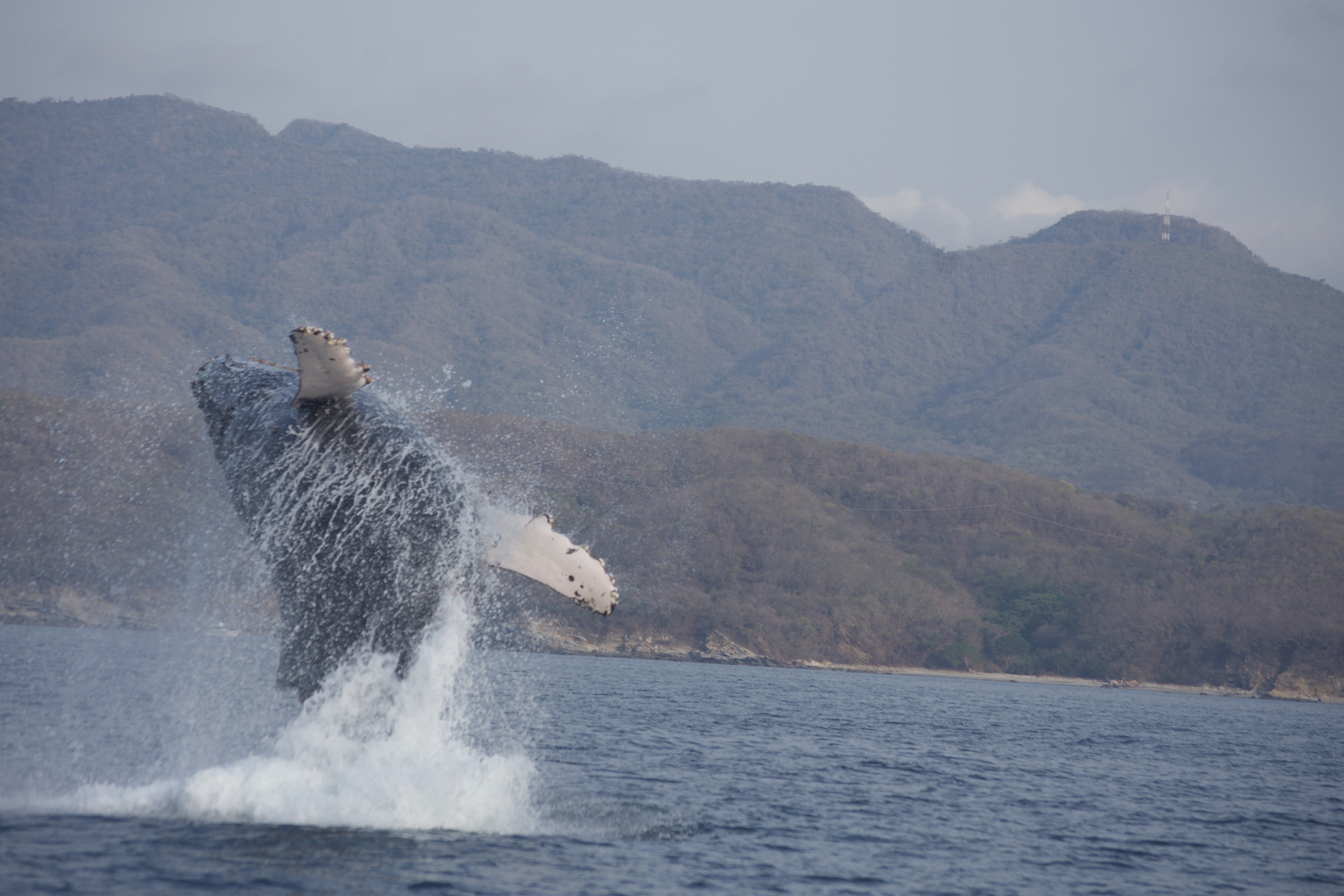
A humpback breaching in the Bay of Banderas, near Puerto Vallarta Mexico. Photo by Greg Herlein
The Two-Year Detour, In One Breath
If you’re new here, the short version: I got accepted into the Bristlemouth Pioneer Program back in late 2023, was granted a SOFAR Spotter dev kit, and promptly watched it get stuck in Mexican customs because I didn’t have a business license to import a $13K package. I nearly lost it entirely, then finally got it on my desk, then slowed way down and started actually reading the fine print.
And the fine print had a mine in it. Section 5.4 of the SOFAR Terms of Use grants them a perpetual, irrevocable, worldwide license to your Spotter data. Your whale recordings become their asset. Their CTO was gracious about it — there are real business reasons — but it just doesn’t work for me. So I returned the Spotter and said thanks - but no thanks.
Then I got my ham license (KO6HAX), and most recently pivoted the whole thing to semi-autonomous drones with my son Luca, because getting permits for unattended marine devices is a non-starter for a hobbyist, but a human-in-the-loop drone you launch and retrieve is a different regulatory animal.
What Bristlemouth Actually Gave Me
Here’s the thing I didn’t fully appreciate at the start. The Bristlemouth + Spotter combination isn’t one product, it’s three things bundled together:
- Power — solar charging and robust distribution down a waterproof cable.
- Networking — 10BASE-T1L, power and data over the same two wires, automatic topology detection.
- Backhaul — the cellular/satellite link that gets your data off the buoy and back to civilization.
The first two are genuinely brilliant engineering and I have no complaints. But it was that third one — the backhaul — that I kept treating as a solved problem I didn’t have to think about. It was in the box. SOFAR ran the network. Data went up, data came down, magic.
When I walked away from SOFAR, I didn’t just give back a buoy. I gave back the backhaul. And that left a hole exactly the shape of a question I’d been dodging:
How does the data actually get from the whales to me?
I Reached for Satellite Because That’s What Was in the Box
This is the classic Maslow’s hammer trap. The Spotter came with satellite, so my brain quietly decided the whale project needed satellite. When I left SOFAR, my first instinct was to go shopping for… another satellite link. Iridium modems, data plans, the works.
But I’m not deploying in the middle of the Pacific. I’m in the Bay of Banderas. Every winter 500–700 humpbacks visit the bay, and I go watch them from small boats within sight of shore. The mouth of the bay is roughly 25 miles (about 40 km) across, ringed by land, with hills rising steeply right behind Puerto Vallarta.
I said this back in the SLOW post and didn’t fully believe my own words yet: “Everywhere I see whales I’m in a spot where my phone works.” Satellite is for when you’re out of range of everything. I’m never out of range of everything. I’m in a bounded body of water with high ground on the edge of it.
That’s not a satellite problem. That’s a line-of-sight radio problem. And line-of-sight radio over water is one of the friendliest RF environments there is.
The License Was the On-Ramp — ISM Is the Legal Tool
Getting KO6HAX was the on-ramp. Chasing my ham license is what dragged me deep into RF — bands, antennas, propagation, link budgets — and it’s the reason I can now look at this problem and actually reason about it. That learning was the real unlock.
But my ham privileges don’t help me where the whales are — at least not right now. Here’s the honest, and slightly frustrating, state of play. I dug into this hard, because I’m the guy who already got bitten by paperwork on this exact project and I read the rules now.
There’s currently no working reciprocal path for a US ham to legally operate in Mexico. The old FCC/SCT reciprocal permit system that ran through 2013 ended when Mexico overhauled its telecom regulator. Mexico still shows up on the old IARP/ARRL reference sheets, but with a footnote saying there’s no procedure in place for US operators to get valid authority. It got more tangled in 2025, when the Mexican Congress dissolved the licensing authority (the IFT) and stood up a brand-new regulator, the Comisión Reguladora de Telecomunicaciones (CRT). A foreigner simply can’t get a license under the current law.
But here’s the hopeful part — the door isn’t slammed shut. In March 2026 the CRT opened a public consultation on new amateur and amateur-satellite rules. The comment period ran into late April and drew 300+ responses, including from Mexico’s IARU society, FMRE. Nothing is official until it lands in the Diario Oficial de la Federación, and there’s no date for that yet. But the draft doesn’t reinstate the old bans on contesting, DXpeditions, or operating from islands — and it reads like foreign hams might eventually get a real Mexican license through roughly the same process as a citizen. Under the proposed zone map, my spot in Nayarit would fall in a new XE4 zone. Someday, maybe, I key up legally as XE4/KO6HAX. I’d genuinely like that. I’m watching FMRE and the ARRL international page for the day the DOF actually publishes — that’s the trigger.
So today, on the air down there legally, my only real options are listen-only or borrowing a local ham’s station and license on-site. Neither of those is a whale backhaul. For that, ham is off the table for now.
And here’s the thing: it doesn’t need to be at the table at all. The 902–928 MHz ISM band is license-free for low-power use across ITU Region 2 — which includes both the US and Mexico — within the local power and duty-cycle limits. No callsign, no treaty gymnastics, no monthly data plan. The legal answer and the technical answer turn out to be the same band. The ham journey is what taught me how to use it well; the ISM rules are what actually let me key it up on the water — legally, today, no waiting on a rulemaking.
Let’s Do the Math, Because I’m That Guy
The reason over-water links are so good is that seawater is a nearly perfect reflecting ground plane and the path is unobstructed. No trees, no buildings, no hills in the middle — just you, the antenna, and the curve of the earth.
The radio horizon (with the usual 4/3-earth refraction factor baked in) is:
d(km) ≈ 4.12 × (√h_tx + √h_rx) [heights in meters]
Start where I actually am: on the boat, operating the drone. The drone is a stone’s throw away — I launched it, I can see it — so this link is almost embarrassingly easy. Call the boat’s whip antenna 4 m and the drone’s stubby mast 1 m:
d ≈ 4.12 × (√4 + √1)
  ≈ 4.12 × (2.00 + 1.00)
  ≈ 4.12 × 3.00
  ≈ 12 km  (about 7.5 miles)
Seven and a half miles of working radius to a drone sitting a few hundred meters off my bow. That’s way more than I’ll ever need — I launch it and retrieve it, I’m never chasing it across the bay. This link has margin to burn.
The link that actually has to reach is the other hop: getting the data home to shore. That’s my house — antenna up on the roof palapa at 30 m (18 m of elevation plus another 12 m of structure) — talking to that same 4 m whip on the boat:
d ≈ 4.12 × (√30 + √4)
  ≈ 4.12 × (5.48 + 2.00)
  ≈ 4.12 × 7.48
  ≈ 31 km  (about 19 miles)
Nineteen miles from my rooftop to the boat. The bay is only ~25 miles across at the mouth, so from my palapa I can relay data off a boat working almost anywhere the whales go. Boat talks to drone; house talks to boat; the data walks home in two easy hops.
And these are just the geometric horizons — over water you routinely get ducting that reaches further. No orbit required. No monthly data plan. No Section 5.4.
Why 900 MHz ISM Is the Answer
One band, one job. The 902–928 MHz ISM band — call it “900 MHz” — is the sweet spot for this, and it happens to be exactly the one I can legally run in the bay. Here’s why it wins:
- Enough bandwidth to matter. It can trickle compressed whale-song clips back to shore — or, with the right radios, push near-real-time compressed audio. That’s the actual job: get the sound off the water, not just a status ping.
- Small, efficient antennas. At a ~33 cm wavelength the antennas are compact enough to bolt onto a drone or a floating node without turning it into a sailboat.
- It loves an over-water path. The higher path loss versus a lower band is a non-issue at these distances over a clean saltwater reflector. Given the horizon math above, a 900 MHz link across the Bay of Banderas isn’t a stretch — it’s the obvious call.
- License-free where I need it. No callsign, no treaty gymnastics, no cloud in the middle. Just the ISM rules and my own two radios.
The node doesn’t need to scream at the sky 24/7. Its edge AI listens, decides “that’s a whale,” and then opens the 900 MHz pipe to move the audio that’s worth moving. Everything else stays local.
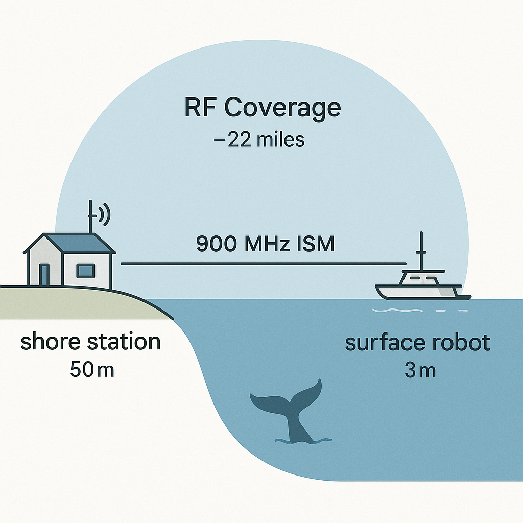
One license-free band, one job: get the whale audio across the bay.
The Part That Makes Me Happiest
Look — the technical elegance is fun, but here’s what actually matters to me. Running my own 900 MHz link, with no cloud service in the middle, means the data is mine. No perpetual worldwide license granted to anyone. If a marine scientist wants to use recordings that come off this system, that’s a decision I get to make, or better yet the science team gets to make — not a term of service I clicked past.
That was the whole reason I left SOFAR. It’s nice to land somewhere that solves the technical problem and the ownership problem in one move.
And it fits the drone pivot perfectly. A human-in-the-loop drone that Luca and I launch, control, and retrieve doesn’t need to phone home from the middle of the ocean — it needs a solid real-time link back to the boat or the shore station while it’s out there working. That link is exactly the 900 MHz path above. The comms architecture and the regulatory reality finally point the same direction. As always with this project, it’s programmed in Go as much as we can manage.
What’s Next
The near-term to-do list, honestly:
- Confirm the ISM device rules and any import/homologation gotchas on the Mexico side (I’ve been bitten by paperwork on this project before — measure twice).
- Bench-test a real 900 MHz ISM link on the actual radios before it goes anywhere near salt water.
- Pool testing, then a shore-to-boat range test in the bay, long before I trust it to a drone.
- A real power budget for the shore station and the floating node.
This is still a side project in my sparse spare time, and it’s still mostly about learning — that’s never changed since the very first post. But for the first time the comms picture is simple instead of hand-waved. I spent two years thinking the hard part was the node. The hard part was admitting I’d been solving the wrong problem: I don’t need to reach orbit, I need to reach a hill.
The whales come back to Banderas Bay every winter. We’ve got natural milestones. Stand by.
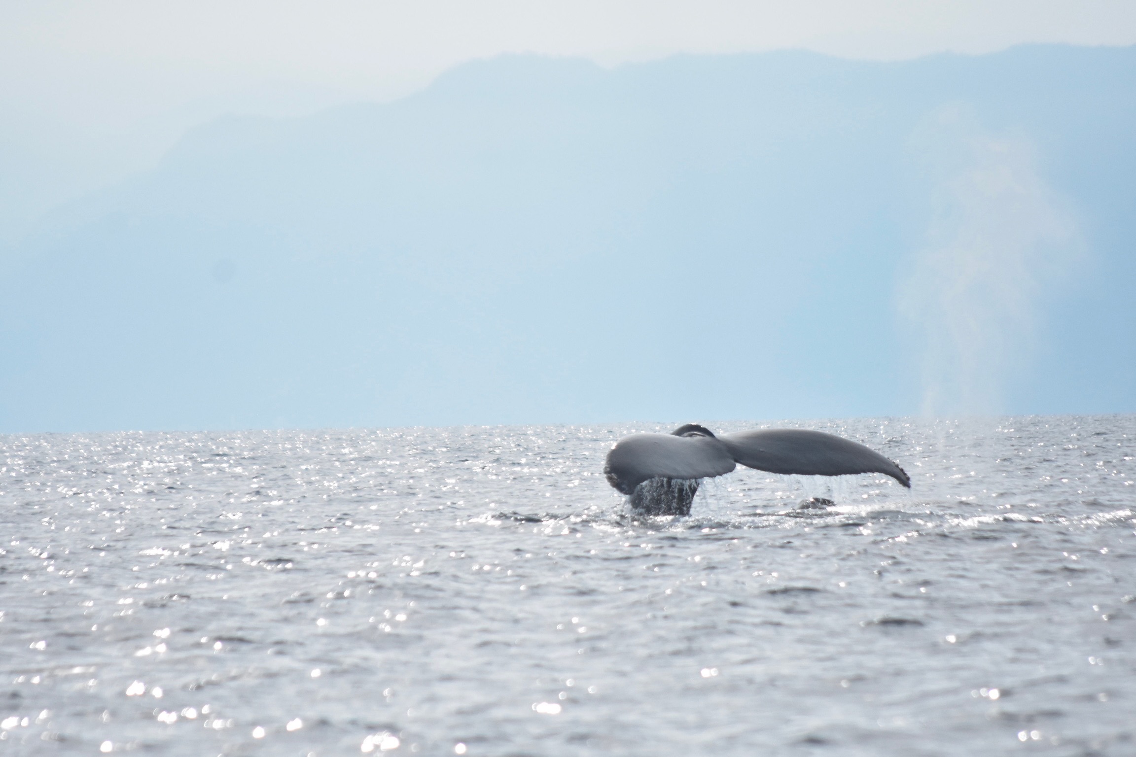
Humpback whale in the Bay of Banderas, near Puerto Vallarta Mexico. December 2023. Photo by Greg Herlein
If this sparked anything — or if you’re a ham, an RF person, or a marine scientist who wants to poke holes in my link budget — please drop me a note on LinkedIn. I’d genuinely love to be told what I’m getting wrong before I get it wet.